For many travellers, the first encounter with South Korea coincides with Seoul. Then come the temples of Gyeongju, the skyscrapers of Busan and, when weather permits, Jeju Island. But the geography of the country invites us to build a completely different itinerary, following not the metropolises but the sea.
Surrounded by water on three sides, Korea has around 280 beaches. The coast changes continuously: sandy and wave-crossed to the east, more jagged and dotted with islands to the south, dominated by the tides and mudflats to the west. It’s not just a place to bathe. There are scenic railways, fishing villages, clifftop paths, cable cars that cross the sea and archipelagos where life continues to follow the ferry schedules.
Following the coast means moving away from the more exported image of South Korea and encountering a less frenetic country. Here the journey is not marked by subway stops, but by the wind, the tides and the departures of boats.
Busan beyond Haeundae, among old houses and trains on the sea
Busan is South Korea’s most famous seaside city, but its coastline doesn’t end at Haeundae Beach. To discover its most intimate side, you can start from Yeongdo, the island connected to the center by several bridges.
The Huinnyeoul Cultural Village occupies the hillside directly above the sea. The homes in the area were recovered starting in 2011, transforming the neighborhood into a tangle of alleys, ateliers and small cafés. From the village you descend towards the Jeoryeong coastal path and the Huinnyeoul tunnel, with the ocean accompanying almost the entire route.
On the eastern side of the city, however, Haeundae Blueline Park has recovered a 4.8 kilometer stretch of the old Donghae Nambu railway. The Beach Train follows the coast from Mipo to Songjeong via Cheongsapo Port, while the small Sky Capsules travel two kilometers on elevated tracks, at a height of between seven and ten meters above the sea. It is one of the most photogenic images of Busan, but above all an unusual way to observe the alternation between cliffs, lighthouses, marinas and beaches.
Tongyeong, the city overlooking an archipelago
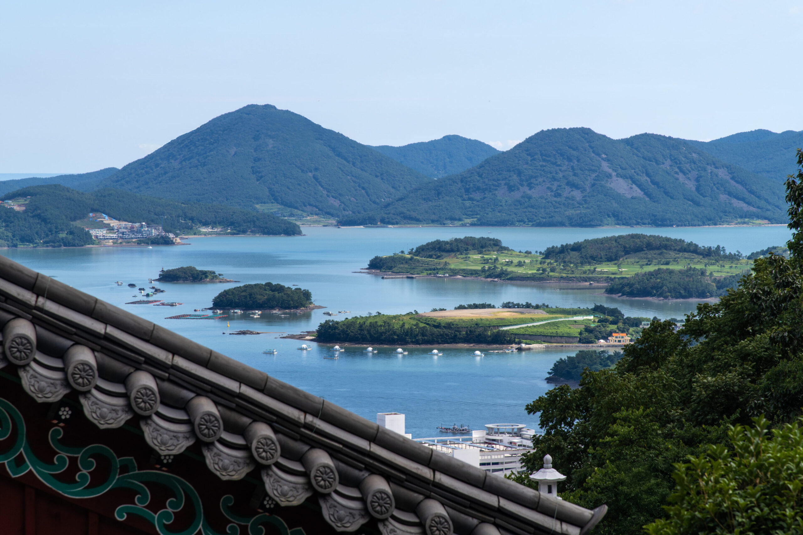
Going down towards the southern coast you arrive at Tongyeong, built between peninsulas, ports and islands. The city overlooks the Hallyeohaesang National Marine Park, the first national marine park established in Korea, which extends between Geoje and Yeosu. More than three quarters of its surface are occupied by the sea.
The best place to understand the geography of Tongyeong is Mount Mireuksan. An almost two kilometer long cable car reaches the upper station in about nine minutes; from here you can continue on foot towards the panoramic points that dominate the port and the islands scattered in the Hallyeo channel.
At sea level, Tongyeong retains an atmosphere linked to fishing and navigation. Boats leave from the port for the surrounding islands, while in the markets and restaurants you can find oysters, raw fish and dishes prepared with products from the archipelago. It is not a city to cross quickly: its charm emerges above all by staying at least one night and observing the port when the lights of the boats replace those of the cars.
Geoje, the island of pebble beaches
Geoje is the second largest island in South Korea after Jeju. It’s connected to both Tongyeong and Busan via bridges, but once you leave the main roads it feels like a separate world from the mainland again.
The coast is characterized by coves, headlands and pebble beaches such as Hakdong, Yeocha, Mangchi and Nongso. A substantial part of the territory falls within the Hallyeohaesang National Marine Park, along with dozens of inhabited and uninhabited islands.
The most particular destination is Oedo Botania, a botanical garden built on a small island that can only be reached by boat. The complex is home to subtropical and rare species, terraces overlooking the sea and a garden decorated with statues, while the eastern part of the island has been left in its natural state. Fans of Korean dramas may also recognize some settings from the final episode of Winter Sonata.
Geoje is suitable for those looking for a trip by car, stopping at panoramic points and small ports. But it can also be explored on foot: one of the sections of the Namparang Trail follows the eastern coast for around 18 kilometres, crossing the sea, mountains and port villages.
Namhae, the rice fields that slope down to the ocean
A little further west is Namhae, an island connected to the mainland and crossed by roads that follow the profile of the mountains. It is one of the places where the agricultural and marine landscapes meet most evidently.
At Gacheon Daraengi Village, rice fields have been created on a very steep slope that slopes down towards the sea. The terraces, built with stones and earth, form 108 irregular levels and tell how the inhabitants have adapted agriculture to a space almost devoid of plain.
However, Namhae must also be observed from above. The hermitage of Boriam stands on Mount Geumsan, at over 700 metres, and is one of the best-known places of prayer in the country. Temples, rocks and vegetation frame the view of the southern sea islands, especially in the early hours of the morning.
It is a Korea far from the neon lights of Seoul: low roofs, fields, panoramic curves and elderly people who continue to work the land while looking at the ocean.
Yeosu, the city of 365 islands
Yeosu is a city built around the sea. Its territory includes 365 islands and an irregular coastline that makes the water visible almost everywhere: from parks, markets, streets and even from above the cable car cabins.
The Yeosu Maritime Cable Car was the first Korean cable car to connect an island and the mainland across the sea. It connects Dolsan to the city center and also has cabins with a transparent floor. The route is particularly evocative at sunset, when the lights of the port and the Dolsan bridge come on.
Near the cable car station is Odongdo, a small island reachable from the coast and known for its paths and camellia trees. In the evening, however, the city changes atmosphere around the stalls and clubs on the sea, where the port landscape becomes part of the nightlife.
Yeosu is one of the best destinations for those who want to combine nature and city without giving up restaurants, train connections and services. It doesn’t have the urban density of Busan, but it retains its maritime energy.
Sinan, the archipelago turned purple
On the west coast, in South Jeolla Province, the landscape changes again. The sea retreats following the tides, revealing vast mudflats, while hundreds of islands make up the Sinan archipelago.
The most curious is Anjwado, known as Purple Island. Roofs, bridges, telephone booths and urban details were painted in different shades of purple, a color also taken from the crops and seasonal events dedicated to lavender and asters. The island also houses the birthplace of Kim Whanki, one of the most important Korean abstract artists of the twentieth century.
The effect may seem built specifically for social media, but the trip also allows you to discover a part of Korea rarely included in international circuits. Here travel takes longer and services are limited: for this reason it is better to plan the route without filling up the days too much.
The west coast doesn’t have the clear water of Jeju or the waves of the east. Its charm comes from the bridges, the tides and the sensation of continually crossing the border between land and sea.
Udo, the small island beyond Jeju
Jeju is no longer a secret destination, but many visitors stop on the main island. Off its eastern coast lies Udo, reachable in about 15 minutes by ferry from the ports of Seongsan or Jongdal.
The island is made up of a single volcanic formation and can be explored by following the coastal road. Among its most recognizable landscapes are Hagosudong Beach and Seobinbaeksa Beach, where the water changes from emerald green to deep blue. The light sand of the latter is made up of nodules of calcareous red algae, a particularly rare characteristic.
Udo is suitable for a day trip, but staying until the last visitors leave allows you to grasp the real rhythm. You can cycle around the island, stop in small villages and taste the products the island is known for, starting with locally grown peanuts.
The sea, however, dictates the rules. Connections may be subject to change in the event of unfavorable weather conditions, so timetables must always be checked before departure.
Ulleungdo, the volcanic island far from everything
The most remote destination is Ulleungdo, in the East Sea. Seventh largest Korean island, it is of volcanic origin and is surrounded by 44 islets. The rock walls descend almost vertically into the water, while paths and walkways connect ports, lighthouses and viewpoints.
The port of Dodong is located approximately 188 kilometers from Pohang and represents one of the main accesses to the island. From here a coastal route starts which allows you to observe the stratifications created by ancient volcanic activity, including lava flows, sedimentary rocks and trachyte.
In Gwaneumdo, a suspended walkway connects Ulleungdo to an island separated over time by marine erosion. The trail leads to observatories overlooking cliffs and lava formations, but access may be limited when winds are strong.
Ulleungdo requires time and flexibility. The sea can change departures and trail conditions, making it necessary to adapt the program. It is precisely this dependence on the elements that preserves its identity: you don’t come here to check out an attraction, but to enter the life of an island for a few days.
Another way to travel in Korea
Crossing South Korea following the coast means giving up the idea of seeing everything. Ferries, local buses and scenic roads dictate a slower pace than the high-speed trains that connect the big cities.
However, it is along the sea that the country reveals some of its deepest differences. The east coast looks at the open horizon; the southern one breaks into hundreds of islands; the western one changes shape twice a day following the tides.
Seoul remains the best place to understand contemporary Korea. But to discover how the country lives, eats and builds its relationship with nature, sometimes you have to leave the capital behind and continue until the road meets the sea.